

A major update has been released for Bikenavi, bringing much-needed flexibility and custom choices to routing and navigation.
We completely revamped the routing settings so you can tailor your journey precisely to your own wishes. You can now choose from three new main profiles – Adventure, Curvy or Direct – and fine-tune the character of the road precisely with sliders and new avoidance options. As usual, you can freely add, reorder and edit waypoints during planning.
The navigation itself has also been improved to be even smoother, clearer and more reliable. Reacting while driving has been made easier, as you can now delete a waypoint directly while navigation is in progress if needed.
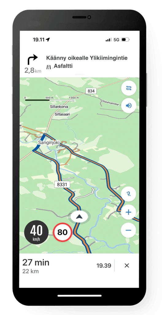
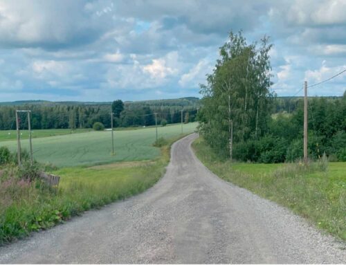
In addition, the navigation view now clearly indicates unpaved sections of the route and also displays this same information directly in the next turn guidance.
New profiles
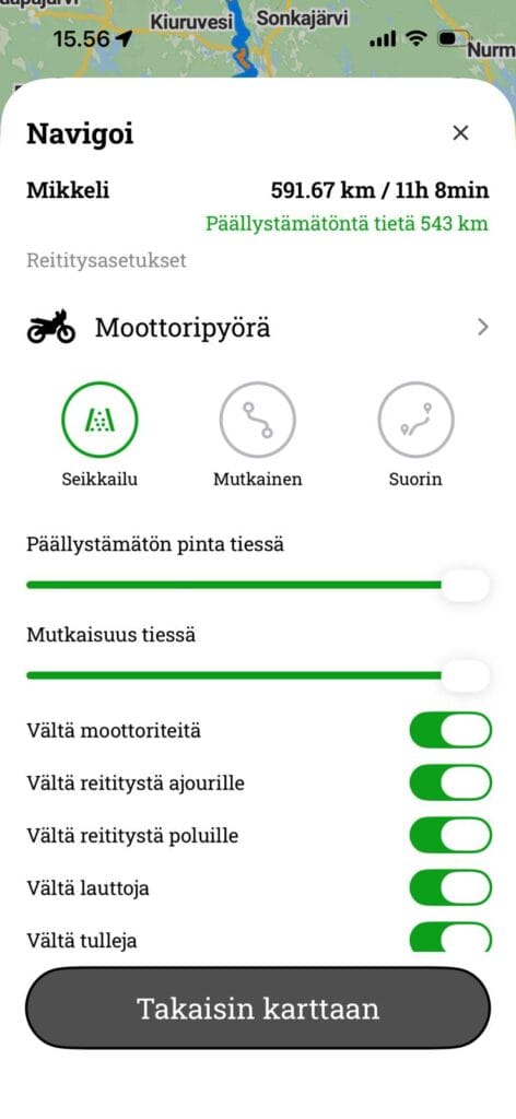
We've updated the route settings, so you can now precisely customise the character of the route before you set off. Included are new main profiles, sliders for adjusting the road characteristics, and useful additional options for fine-tuning your route.
Adventure
This profile steers away from main roads and favours varied surfaces. It's an optimal choice for seeking out smaller roads and gravel tracks.
Curvy
This option seeks out the most bends and curvy road sections for the route. It's perfect for enjoying the drive when there's no rush on travel time.
Straight
This profile selects the most efficient and fastest route to the destination without unnecessary detours. It favours clear main routes, making it ideal for direct travel.
Example
The same route calculated with different profiles.
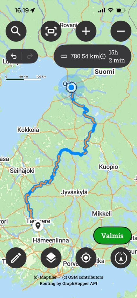
Route calculated with adventure profile. The route follows small roads. Length 546 km, of which 511 km are unpaved roads.
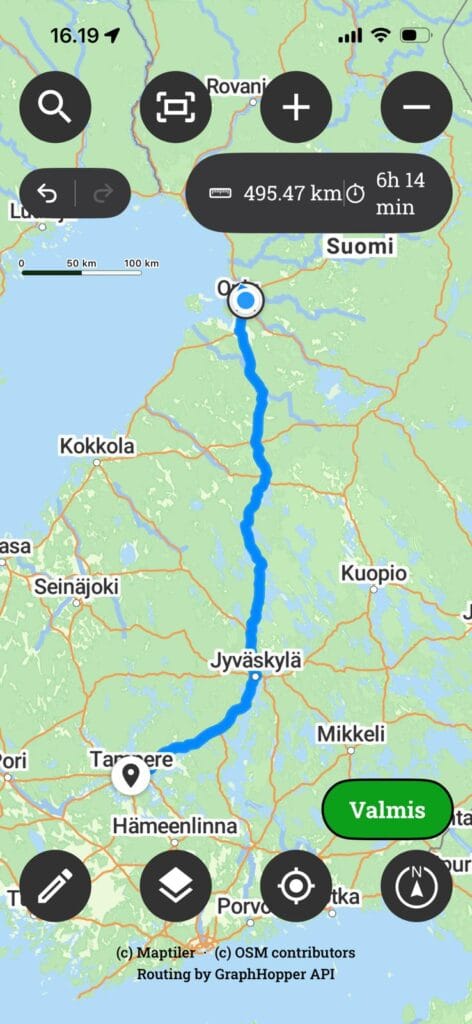
A route calculated with the straight profile. The route follows main roads. Length 470 km.
Sliders and settings for fine-tuning
Just main profiles aren't always enough, so we've implemented two sliders for you to fine-tune the route weightings:
Unpaved road surface Determines how actively the routing seeks to avoid asphalt. In the minimum setting, it stays purely on paved surfaces, in the middle setting, it includes well-maintained gravel roads, and in the maximum setting, the algorithm primarily prioritises dirt roads and smaller routes, minimising asphalt transfers.
Road complication It affects the shape and geometry of the route. The left side seeks straight and fast road sections. When pulled to the right, the algorithm begins to emphasise curves and elevation changes, which can consciously lengthen the journey to achieve a more dynamic driving route.
In addition to the sliders, there are five clear selector switches that allow you to limit the routing to precisely match your own equipment and driving style:
- Avoid motorways Route away from fast, direct main roads onto smaller, more scenic roads.
- Avoid routing along wheel ruts: Keep to the route's official road network and prevent guidance onto forestry roads' ruts or poorly maintained tracks.
- Avoid routing onto paths: Ensure that the route does not stray onto narrow paths or off-road tracks that are not suitable for larger bikes or road riding.
- Avoid ferries Bypassing the ferry and cable-ferry connections by land so that the journey is not interrupted by waiting for timetables.
- Avoid customs duties: Avoid toll roads from route options when travelling in areas where tolls are in use.
Clearer navigation
Real-time navigation itself has been refined to be even smoother, clearer and more reliable. The navigation view now directly indicates unpaved sections of the route on the map and shows the same information in the next-turn guidance, so you always know precisely what kind of surface you are turning onto. Furthermore, modifying the route while driving is effortless: if necessary, you can remove an extra waypoint directly while navigating without interrupting your journey.





 Finnish
 English
 Swedish
 German
 French
 Spanish