

We have compiled instructions and frequently asked questions on this page. You can use the search field or search for a suitable topic in the subject areas below.
Download the Bikenavi app From the App Store or Google Play.
Create an account and log in. To register, you need an email address and password.
Verify account via the link sent to your email.
Choose a suitable subscription period (1, 6 or 12 months) or continue with the free version. When you subscribe, you can try the app for free for 7 days. You can also use the app for free, but the features will be limited.
Take advantage of browser-based route planning at: app.bikenavi.fi


Login
- Download the Bikenavi app From the AppStore or From GooglePlay
- Tea account and log in to the application
- An account is created using an email and password.
- Account verification is done using a link sent to your email.
- After verification, you can use the app but the functions are limited.
Order and trial
- Place an order on mobile or try the app with all features
- Choose a suitable subscription duration 1, 6 or 12 months
- You can try the app 7 days upon order
- Log in to the application (app.bikenavi.fi) with the same credentials.
Bikenavi can be used worldwide for route planning and navigation. In addition, pavement information and other location data are available in Finland and Sweden.
Navigation quickly
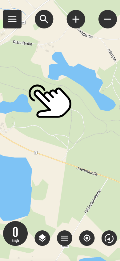
Select destination from the map
You can quickly start navigation by long pressing on the desired destination on the map. Long press opens a menu where you can select routing settings.
See more detailed settings point 8 Navigate quickly.
Option 1: Draw freely
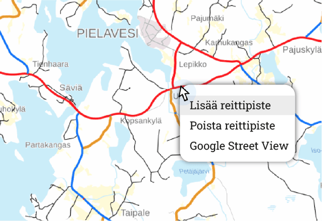
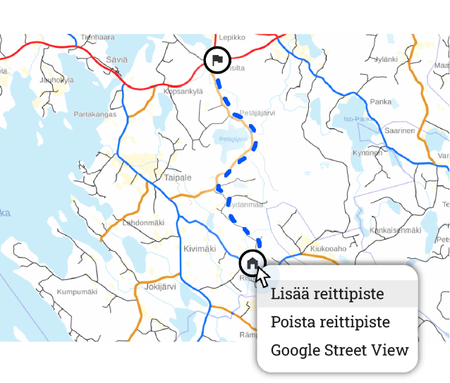
- Add or remove waypoints right-click. If you are using a phone or tablet, add a period long press.
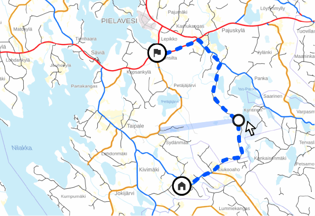
- You can move all the points you have added freely on the map and also add waypoints to the route.
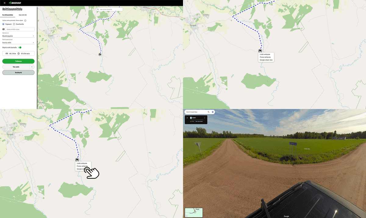
Functions on the map, mouse right handle.
- Add waypoint
- Delete waypoint
- Google Street View
View
If you are using a phone or tablet, the functions will appear long press.
1. Add the desired starting point
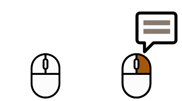
- Use on a computer right mouse button.
- On your phone or tablet long press.
2. Create a route by adding points
- It is a good idea to add waypoints, for example, to turns. (The route calculation can be adjusted if there are too few points.)
3. Add waypoints
- Waypoints help you plan a complex route.
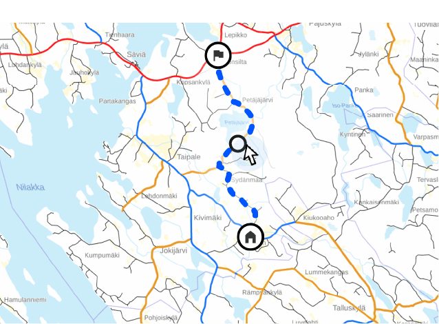
4. Adjust the route if desired
- You can move all waypoints.
Option 2: Use addresses as a guide
- Change drawing mode from selection
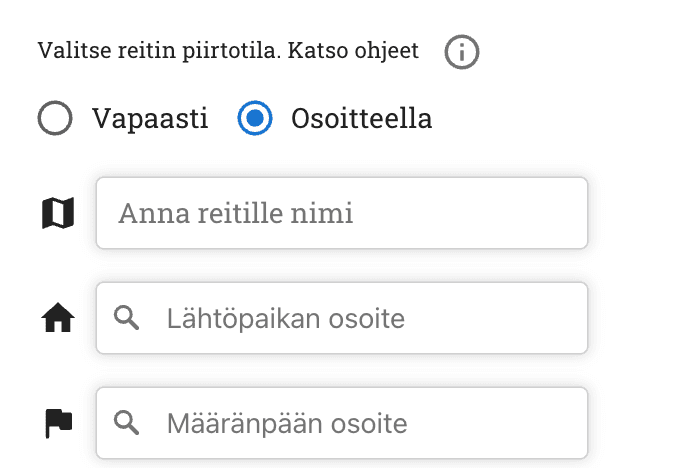
You can easily make a longer route by entering
- Departure address
- Destination address
- Intermediate stages
- All points can still be moved
1. Add your desired departure point and destination
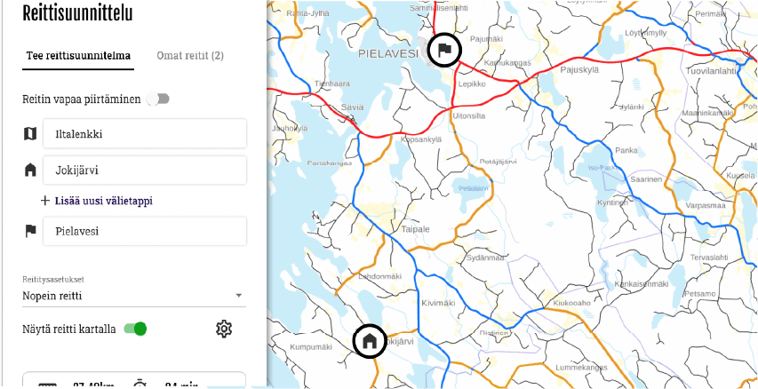
2. Create a route by adding waypoints
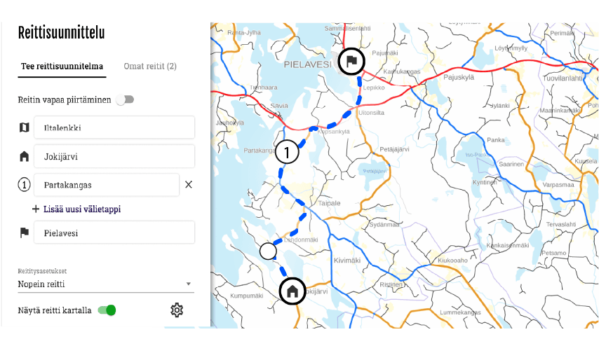
3 You can add waypoints and waypoints to your route
Waypoints help you create a complex route.
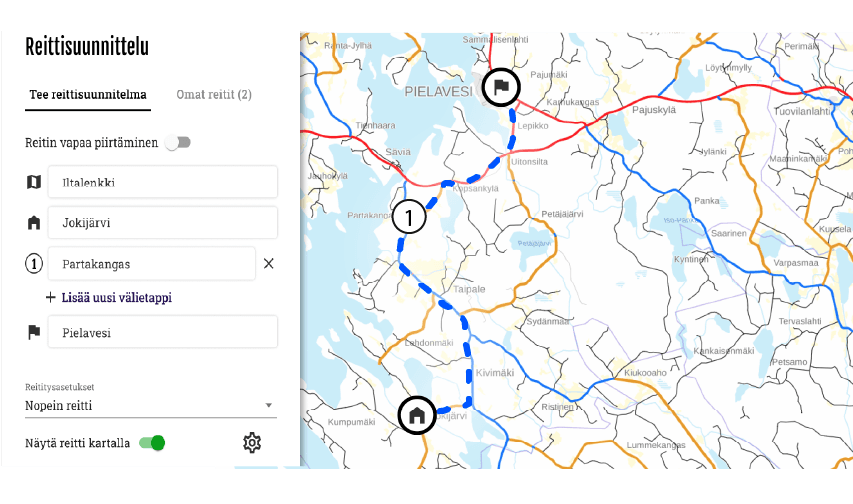
- You can adjust the route by moving waypoints and intermediate stops.
Navigation quickly
Select destination from the map
You can quickly start navigation by long pressing on the desired destination on the map. Long press opens a menu where you can select routing settings.
See more detailed settings in section 8 Navigate quickly.
Vehicle
You can choose as a vehicle
- Motorcycle
- Bicycle
Routing settings
There are two basic choices in routing settings
- Fastest route
- Allow routing on paths. The route may include small paths, ensure drivability!
With advanced routing options, you can:
- Avoid motorways if you want to drive on quieter routes or enjoy the scenery without high speed limits.
- Avoids ferries, making the route entirely overland without crossing waterways.
- Avoids toll roads, routing to toll-free sections.
- Avoids unpaved roads, so the route only runs on paved sections
Hiding the route
- Option to hide/show route on map
Routes and instructions

My routes
Plan your route in advance on your computer at app.bikenavi.fi. Your saved routes will sync to the app, where you can:
View all your routes.
Set route on the map for navigation.
Export route As a GPX file.
Remove from the route application.
Imported routes
You can upload your own GPX files to the app. After importing, you can:
See all imported routes in one view.
Set route on the map to follow.
Remove from the route application.

Instructions
- You can find more detailed instructions for using the app here.
Profile
In the profile you will see:

Usernames
- Your username (email address)

Order valid
- You can see how long the subscription is valid (date).

Order
- You can manage your subscription in the app store.

Means of transport
You can change your means of transport:
- For a motorcycle
- For a bicycle
The selected mode of transport is used to calculate the route in route planning and express routes.
Other

Theme
- You can switch the app to either a light (default) or dark theme. The theme you choose will also affect the appearance of the maps.
- light theme -> light maps
- feel the theme -> dark maps

Feedback
- You can send feedback or report a problem using the web form.

Analytics
- You can influence the visibility of analytics

Compass
- You can calibrate the compass if the bearing or position is not working properly.

Language
- You can change the language of the application

Descriptions
- You can see all the descriptions of the application

Log out
- You can log out of the app
Recording
Once you have planned your route save route. The route is saved My routes tab.
Export
- You can open a saved route in the Bikenavi mobile app
- You can export the route as a GPX file* to your desired navigation device or application
- Press the “Export route” button and select the desired file format
- Export route advanced functions My routes / New route
* GPX is a file format that allows you to transfer a route to another device or application.
Pause
- This function interrupts route creation, no data is saved.
Routes and instructions
My routes
Plan your route in advance on your computer at app.bikenavi.fi. Your saved routes will sync to the app, where you can:
View all your routes.
Set route on the map for navigation.
Export route As a GPX file.
Remove from the route application.
Imported routes
You can upload your own GPX files to the app. After importing, you can:
See all imported routes in one view.
Set route on the map to follow.
Remove from the route application.
Instructions
- You can find more detailed instructions for using the app here.
Profile
Below the profile you will find the following information.
User name
- My username (email address)
Order valid
- Subscription valid, you can see until when the subscription is valid (date).
Means of transport
You can change your mode of transportation.
- For a motorcycle
- For a bicycle
The selected mode of transport is used to calculate the route in route planning and express routes.
Other
Feedback
- You can send feedback or report a problem using the web form.
Analytics
- You can influence the visibility of analytics
Descriptions
- You can see all the descriptions of the application
Language
- You can change the language of the application
Log out
- You can log out of the app
My routes
- Saved routes can be found My routes from the tab
- The newest route is at the top.
- Activities on the route behind 3 points:
- Route deletion
- Switching to editing mode
- Route export

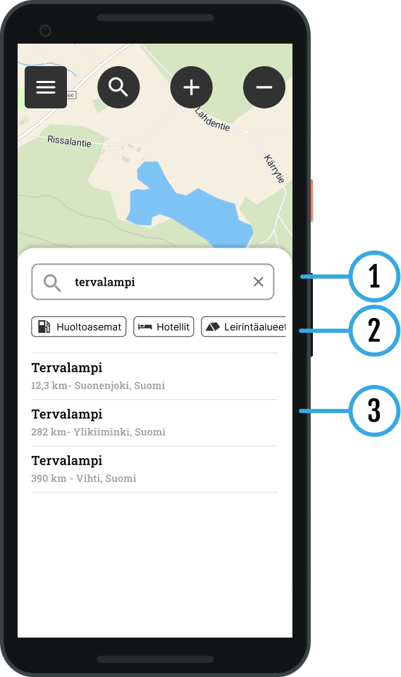
1 Search
You can find the items you are looking for by typing a location in the search field. name, address or category. The search function suggests suitable results for you based on the information you enter.
2 Search quickly
You can use ready-made categories, which help you quickly find hotels and campsites, for example, directly from the map view. Select the desired destination from the list:
- Gas stations
- Pharmacies
- Hotels
- Repair shops
- Campsites
- Accommodation
- Attractions
- Banking services
- Grocery stores
3 Results
Search results are displayed below.
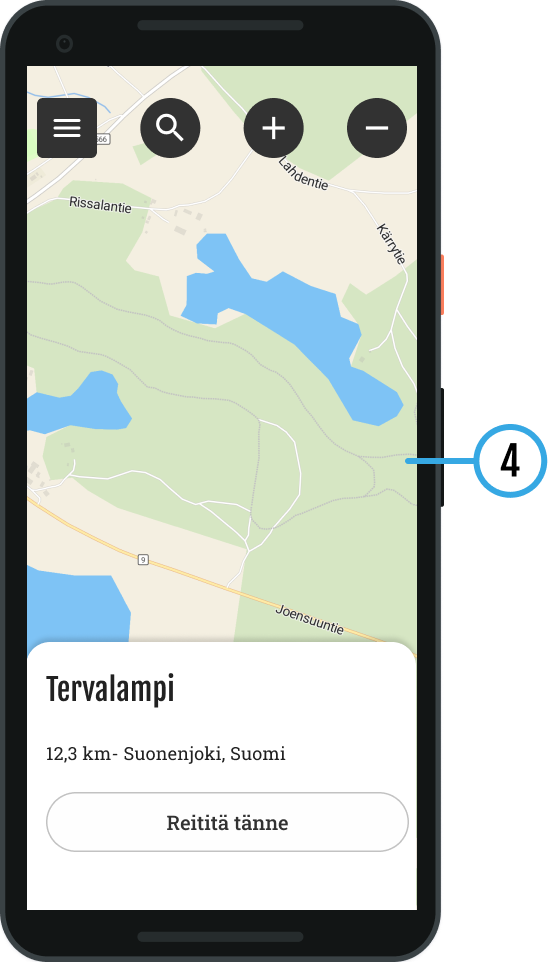
4 Search results on the map
Result(s) displayed on the map
- You can select the desired destination
- The location information is displayed:
- Name / Address
- You can make a Quick Route to a destination Route herebutton
Search within the map area
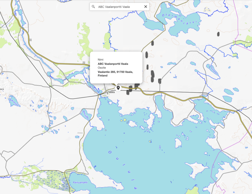
You can search for a gas station or individual address in the visible map area to help you plan.
You can search by typing in the search field:
- Name (Vaasa or Neste Oulu Bar)
- Address (Isokatu 10, Oulu)
- Category (e.g. gas stations)
Search function
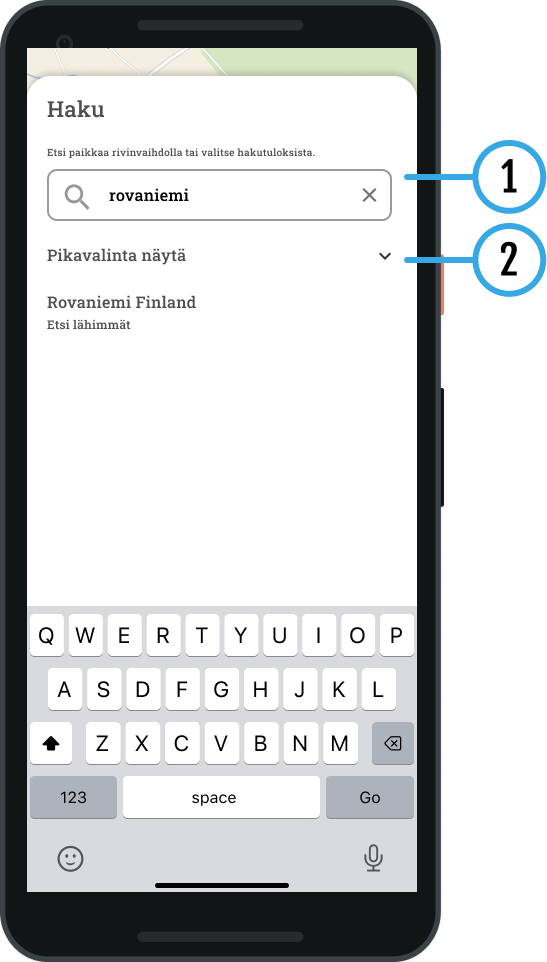
1 search
You can find the items you are looking for by typing a location in the search field. name, address or category. The search function suggests suitable results for you based on the information you enter.
2 Search quickly
You can use ready-made categories, which help you quickly find hotels and campsites, for example, directly from the map view. Select the desired destination from the list:
- Gas stations
- Pharmacies
- Hotels
- Repair shops
- Campsites
- Accommodation
- Attractions
- Banking services
- Grocery stores
3 Search results on the map
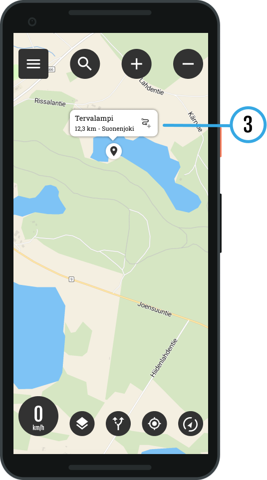
The results are displayed on the map:
Select destination: Tap an item to open its details.
Information: You will see the name and address of the place.
Navigation: To start navigation, press route symbol.
Add or remove waypoints right-click. If you are using a tablet, add a period long press.
- You can move the points you added freely on the map
- You can also add waypoints to your route
- To delete points from the map, zoom in on the point first (you cannot delete a point from a distance)
Activities on the map, right mouse button or long press
- Add waypoint
- Delete waypoint
- Google Street View
View
Map bases
Bikenavi offers 6 different map base options.
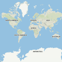
Navigation
(requires subscription)
The map emphasizes the precise road network and highlights key location information. It provides a clear and detailed overview of the area, making it easy to navigate and choose routes. Unpaved roads are also clearly visible in the road network., so you always know in advance what kind of road awaits you.
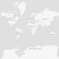
Plain
(requires subscription)
A minimalist and clear map that highlights the road network, trails and key location information. High contrast without distracting details makes navigation easy in all conditions.
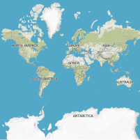
Terrain
(requires subscription)
Shows terrain features with clear contour lines and shading, and highlights key location information. The map combines elevation data and water bodies into an accurate and easy-to-read entity.
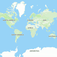
Outdoor
(requires subscription)
A map especially for cyclists and outdoor enthusiasts. The map brings the terrain to life by clearly highlighting even the smallest details and contains many ready-made routes from different countries.
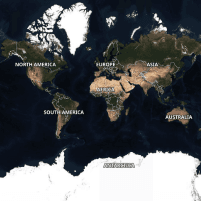
Aerial view
(requires subscription)
Accurate satellite images help to visualize terrain in real-world conditions. Aerial photography is an invaluable aid, for example, in choosing the best camping spot or landing spot.
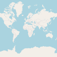
Basic
A base map based on OpenStreetMap data provides an overview of the surroundings. This is the only map option available in the free version of the app.
The following location information is highlighted on the maps:

Gas stations

Picnic areas

Campfire sites

Campsites

Protections

Desert huts

Accommodation

Bargain

Viewpoints

Attractions
Weather information
Weather functions can be found directly in the route planning view (app.bikenavi.fi).
You can view the weather forecast hourly for up to five days.
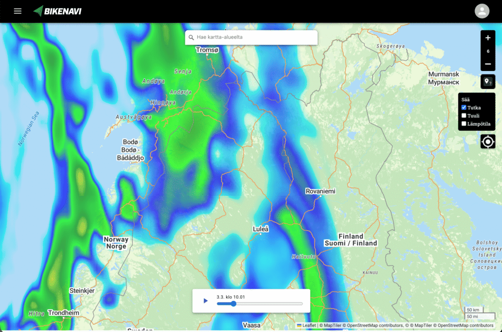
Real-time rain radar: Follow the movement of the fronts and time the breaks correctly.
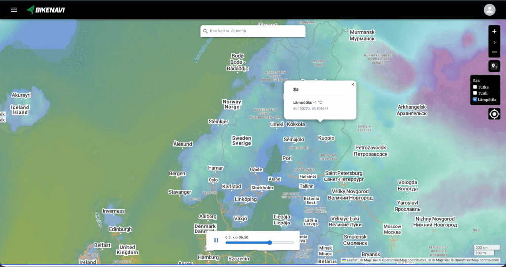
Ltemperature: Check the conditions along the route and choose the right equipment.
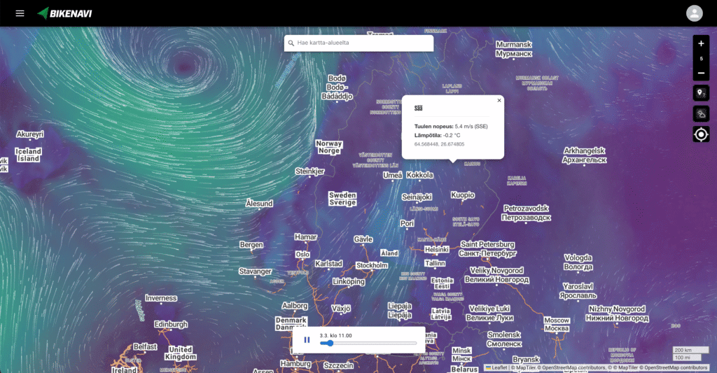
Wind: Check the conditions along the route and choose the right equipment.

The compass shows the direction of travel. This is enabled when heading mode is selected.
Map bases
Bikenavi offers 6 different map base options.
Navigation (free)
The map emphasizes the precise road network and highlights key location information. It provides a clear and detailed overview of the area, making it easy to navigate and choose routes. Unpaved roads are also clearly visible in the road network., so you always know in advance what kind of road awaits you ahead
Clear (requires subscription)
A minimalist and clear map that highlights the road network, trails and key location information. High contrast without distracting details makes navigation easy in all conditions.
Terrain (requires subscription)
Shows terrain features with clear contour lines and shading, and highlights key location information. The map combines elevation data and water bodies into an accurate and easy-to-read entity.
Outdoor activities (requires reservation)
A highly accurate topographic map especially for cyclists and outdoor enthusiasts. The map brings the terrain to life by clearly highlighting even the smallest details and contains many ready-made routes from different countries.
Aerial view (requires subscription)
Accurate satellite images help to visualize terrain in real-world conditions. Aerial imagery is an invaluable aid, for example, in choosing the best camping spot or landing spot.
Basic (requires subscription)
The base map based on OpenStreetMap data provides a good overview of the surroundings.
Profile and settings
In settings you can:
- View your current order and
- change default vehicle (motorcycle / moped)
- Open instructions in a new tab
- Open and see what's new in the app
- Log out of the app
Error: The application requires a subscription
If you have placed an order but the app.bikenavi.fi application states 'The application requires a paid subscription', log out and back in. This action will update your order status and fix the problem. If the message does not disappear, please contact our customer support.
Road descriptions
Road explanations on the Navigation Map.
Motorway: Multi-lane highway with grade separations
Main road: Regional main road connecting cities
Regional road: Regional connection route between local centers.
Local roads: Roads are visible at zoom levels 10-13 and make route planning easier. Level visible in Europe.
Smaller road: Roads connect villages and residential areas.
Unpaved road: The road surface is not paved, usually gravel.
Service road: Access road to properties, courtyards and parking spaces.
Cycle path Intended for cycling and general pedestrian use.
Cycle path Intended for cycling and general pedestrian use.
Driving track: Often unpaved and road condition can vary considerably.
Path: A narrow path intended for walking, cycling or outdoor activities. Not suitable for cars.
Path: A more natural narrow path for outdoor activities, accessible on foot.
The saved route is immediately visible in the Bikenavi mobile app.
Road descriptions
Road explanations on the Navigation Map.
Motorway: Multi-lane highway with grade separations
Main road: Regional main road connecting cities
Regional road: Regional connection route between local centers.
Local roads: Roads are visible at zoom levels 10-13 and make route planning easier. Level visible in Europe.
Smaller road: Roads connect villages and residential areas.
Unpaved road: The road surface is not paved, usually gravel.
Service road: Access road to properties, courtyards and parking spaces.
Driving track: Often unpaved and road condition can vary considerably.
Path: A narrow path intended for walking, cycling or outdoor activities. Not suitable for cars.
Path: A more natural narrow path for outdoor activities, accessible on foot.
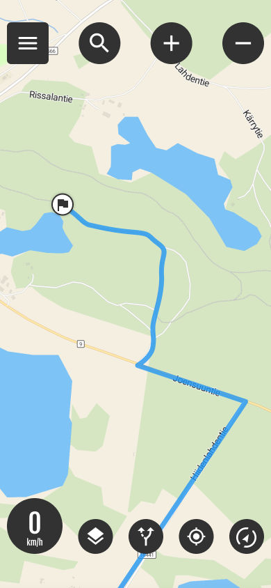
My own and imported routes

Routes button
Open the menu, you will see own and imported your route. Select the desired route on the map by tapping The menu closes and the route is drawn on the map.
- The assumption is that Follow the route You can change the status from the active route settings.

Active route
The Active Route symbol indicates that a route is selected on the map.
- When you open the menu again, you will see the length of the route.
- You can also hide the route by pressing "Hide” button. Browsing the map may be easier if the route is not visible.
- You can change '’Follow the route’' mode to guided navigation by pressing (Navigate) button.
You can pause the route by pressing the Active Route button and selecting “Pause”".
Importing a route to My routes
You can import a route into the application in GPX format. The import is done through the application via the main menu.
- Open Menu
- Select Imported routes
- Select Import GPX file
- Select the file you want
- The file is imported and added. Imported routes
- You can also open the GPX file directly on your phone
Route planning on the web
Plan your route carefully in advance on your computer and then open it in the mobile app.
Have you purchased a Bikanavi subscription? The free version has limited functionality.
Different modes of location
Locate yourself by pressing the location button.

My location on
You can see the location on the map.

In map view
The blue round symbol indicates your location.

My location off
Your location is not available. You can re-locate yourself by pressing the button.
You can download the app:
- From the AppStore
or
- From Google Play
My location
By pressing the location button you can see your location on the map.
In map view
The blue round symbol indicates your location.
Yes, you can try Route Planning by subscribing to Bikenavi in the app store. The trial lasts for 7 days when you subscribe.
Different map modes
Press the symbol to change the mode.

Direction of travel (default)
The map always turns in your direction, so you can see where you are going. This is useful when driving off-road.

In map view
The blue round symbol with an arrow in front of it indicates the direction of travel.

Direction of travel and tilt
The direction of travel has been selected and the map has been tilted slightly. Navigation is easier.
In map view
The blue round symbol with an arrow in front of it indicates the direction of travel.

North locked
Map orientation locked to north. It is easier to read the map if the orientation is north.
Navigate quickly
Select destination from the map
You can quickly start navigation by long-pressing on the desired item on the map (long press)
Pressing opens where routing settings are selected.
Select routing option and navigation method
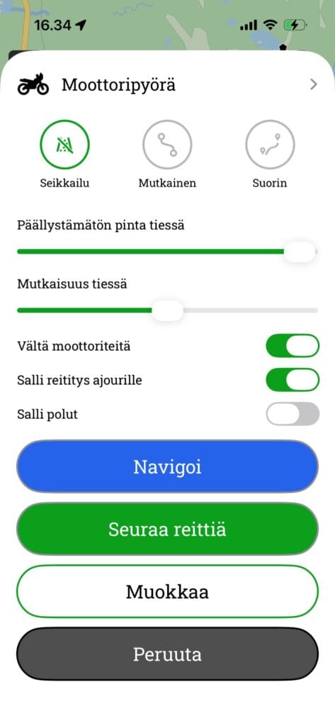
1 routing options
Motorbike
- Adventure It selects routes with few roads and maximises the proportion of sand and gravel tracks.
- Curvy: Optimise the route so that it always follows the most winding and twisting roads possible
- Straightest: It always selects the most efficient and direct route from the starting point to the destination.
Bicycle
- Adventure Also utilize small paths and shortcuts in the terrain when routing.
- Curvy: Optimise the route so that it always follows the most winding and twisting roads possible
- Straightest: Always selects the most efficient and direct route from the starting point to the destination
Advanced settings
- Avoid motorways
- Avoid routing onto the carriageway
- Avoid walking on the footpaths
- Avoid ferries
- Avoid customs duties
Active route
The Active Route button allows you to:
- Starts route navigation if you have been following a route
- Hides the route
- Cancels the route
Making a route
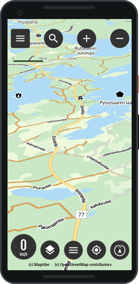
Choose a destination
- Select Destination wanted from the map
- Press Long press
- Routing settings are opening
Or
- From the main view, select the Routes menu
- Select Create a new route
- Routing settings are opening
Routing settings and editing
- Select the desired routing profile
- Adventure
- Curvy
- Straight
- Use additional settings if necessary
- Avoid motorways
- Avoid routing onto the carriageway
- Avoid walking on the footpaths
- Avoid ferries
- Avoid customs duties
- Select Modify, route editing opens
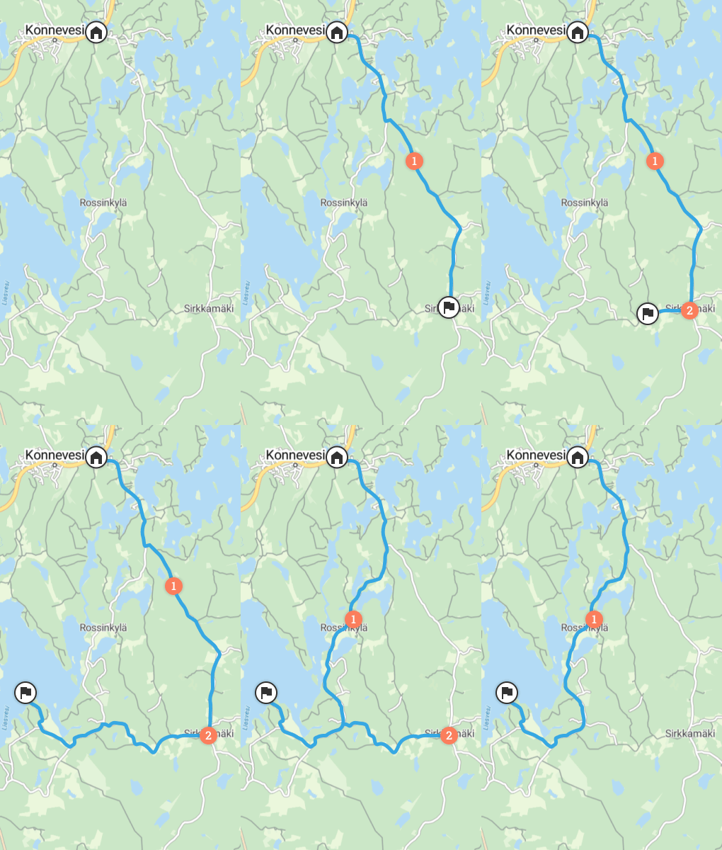
You can easily edit the route
- Add new waypoint with long press
- Delete waypoint with long press
- And press the trash can
- You can move drawing all the dots
- You can add between points (note: the dot cannot be added from afar)
- You can use the undo / redo functionality
- You see uncoated routes in orange
Navigate quickly
Select destination from the map
You can quickly start navigation by long-pressing on the desired item on the map (long press)
Pressing opens where routing settings are selected.
Select routing option and navigation method
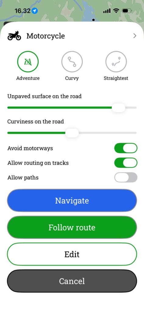
1 routing options
Motorbike
- The most direct route: Only drive on official roads designated for motor vehicles.
- Allow routing for paths: Use caution. The route may also include narrow paths, cycle paths or other sections unsuitable for motorcycles.
Bicycle
- The most direct route: Guides you to your destination along the most direct route, but avoids off-road paths.
- Allow routing for paths: Also utilize small paths and shortcuts in the terrain when routing.
Advanced settings
- Avoid motorways
- Avoid unpaved roads
- Avoid ferries
- Avoid customs duties
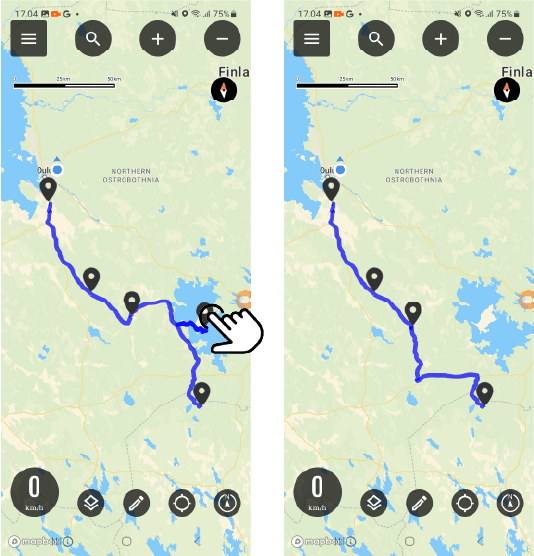
2. Follow the route (Unguided)
This mode shows the route to the destination on the map, but does not provide separate driving directions.
3. Navigate (guided and voice control)
This feature guides you to your destination using visual instructions and voice guidance.
While navigating, you can:
To look at the whole: View the entire route at once.
Manage sounds: Turn driving instructions sounds on or off.
Explore the environment: Browse the map freely while navigation is in progress.
Return to view: Centers the map back on your location.
Stops navigation: End the tour at any time.
4. Cancel route creation
Active route
The Active Route button allows you to:
- Starts route navigation if you have been following a route
- Hides the route
- Cancels route navigation
You cannot use app.bikenavi.fi-route planning application for navigation, but With the Bikenavi mobile app navigation is successful.
You can quickly tilt the map by selecting the map mode: Direction of travel and tilt
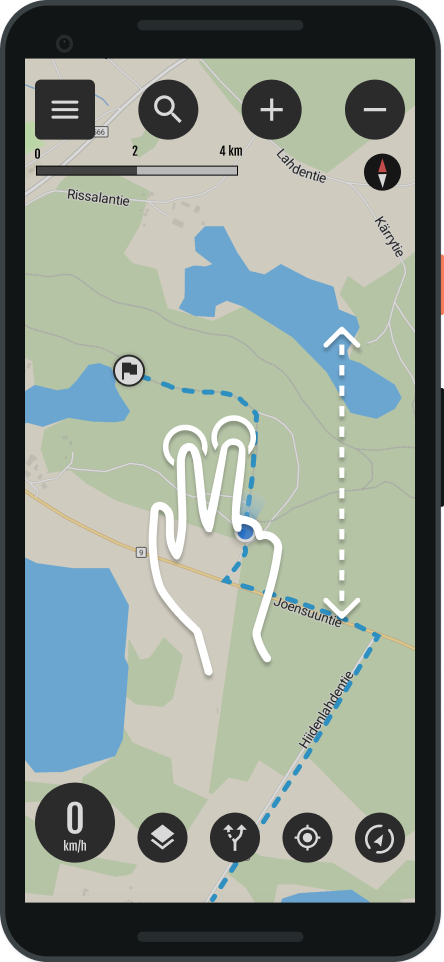
Map tilt
You can also tilt the map yourself.
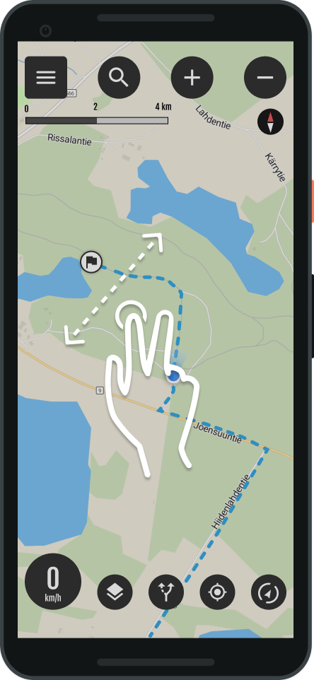
- Tilt the map with a two-finger gesture
- Pushing forward, tilts the map
- Pulling back, returns the tilt to normal.
- Tip: The push and pull gesture with both thumbs works best
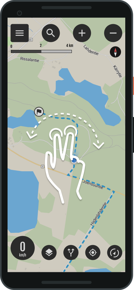
Map rotation
- Rotate the map with a two-finger gesture
Dragging the map
- You can move the map by dragging
Getting started and settings
- You can edit Appropriate routes
- Select the route you want to edit.
In edit mode
- You can change the vehicle
- Routing settings
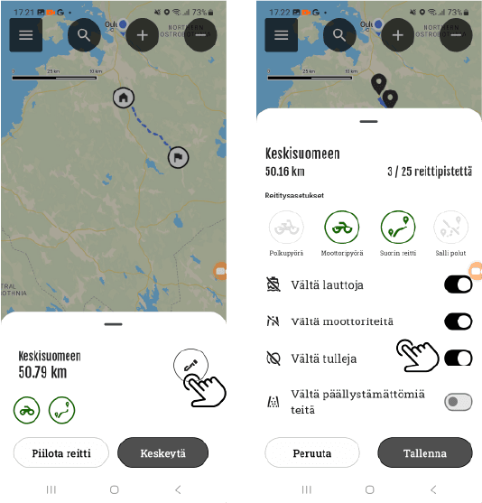
Editing a route
You can edit your own routes as follows:
Continue the route: Long press to add points.
Transfer points: You can move all points on the route.
Delete point: Tap a point to remove it from the route.
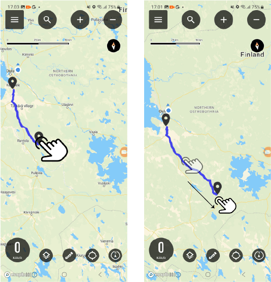
Continuing the route
You can continue the route by adding a new one waypoint by long pressing the map at the desired location.
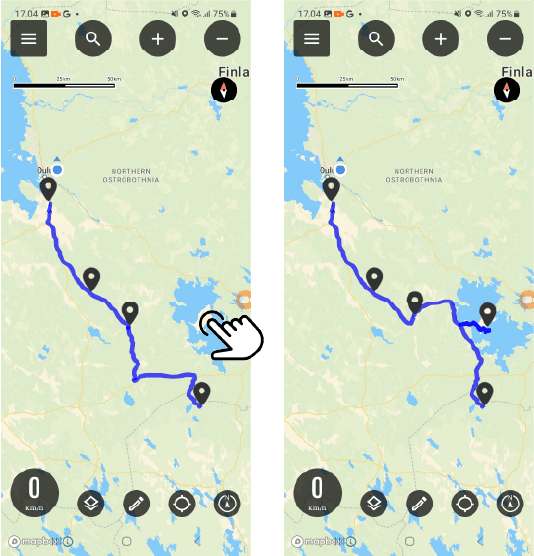
Point movement
Select the point you want to move and drag it to the desired location on the map.
Point removal
End of editing
You can stop editing by pressing the pencil symbol in the submenu.
Then save the changes you made to the route.
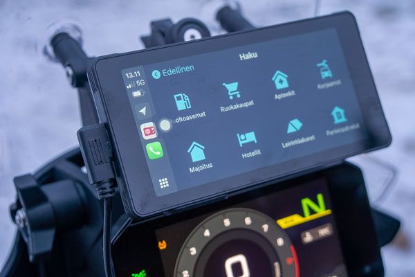
Connecting to CarPlay
Bikenavi's iOS app supports Apple CarPlay.
- Connect your phone to an external device or motorcycle system via Bluetooth or cable.
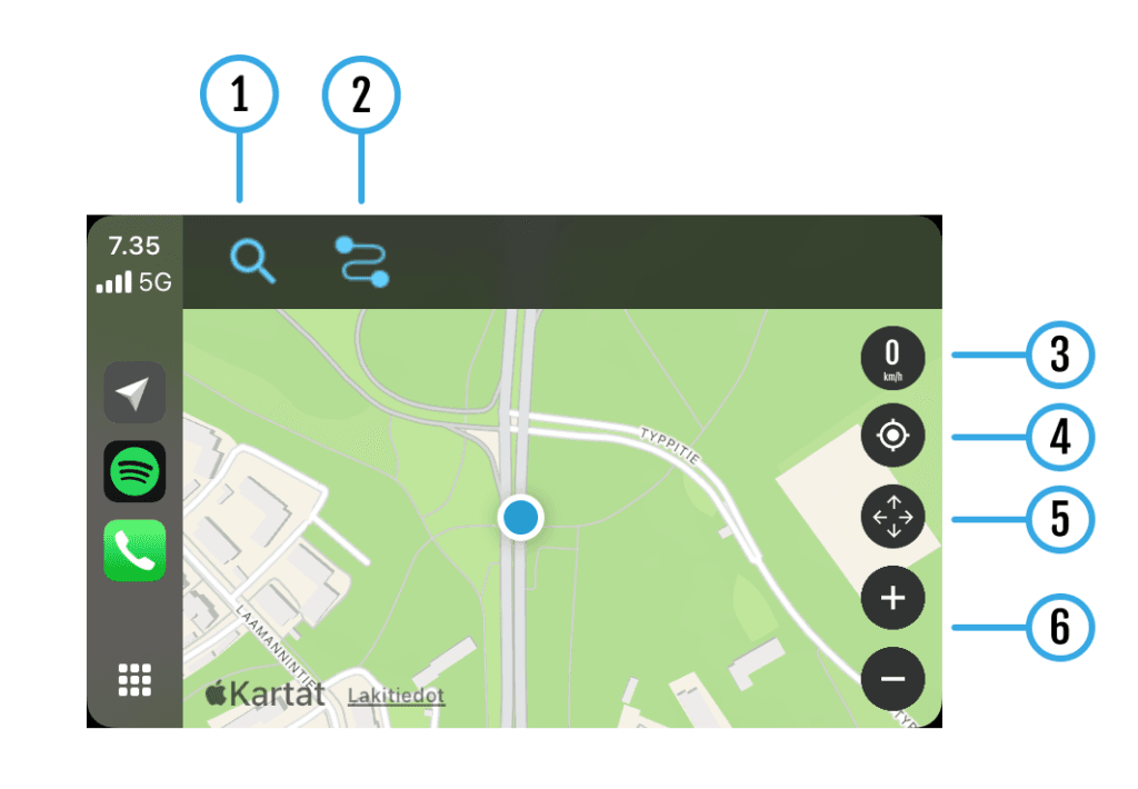
Functions and features
- Search function
- My routes
- Speed
- Different map modes
- Moving the map
- Zoom function
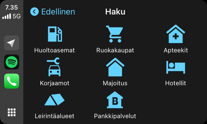
1 search function
You can search quickly using categories.
- Select a category
- Results are displayed
- You can create a route to a destination of your choice
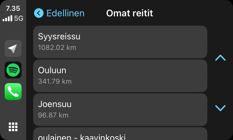
2 My routes
In My Routes you can see the routes you have planned.
- Choose your desired route
- The route to the destination is shown on the map
- You can navigate to a destination by following a route
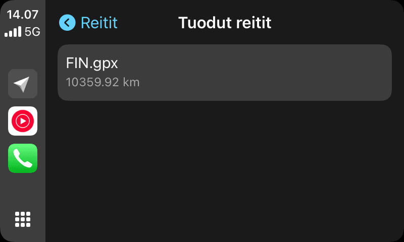
2 Imported routes
In Imported routes, you can see the routes imported into the app.
- Choose your desired route
- The route to the destination is shown on the map
- You can navigate to a destination by following a route
Other functions (3-6)
3 Speed
- Shows driving speed
4 My location
- Locate to your location
5 Moving the map
- You can move the map with the arrow button
- Can locate back to your location
6 zoom function
- You can zoom the map with the + and – buttons.
- Note function cannot be used while the vehicle is moving
The "Rides Groups" feature makes it easy to arrange rides and share routes within a group. You can share common routes directly with the group, making ride planning effortless.
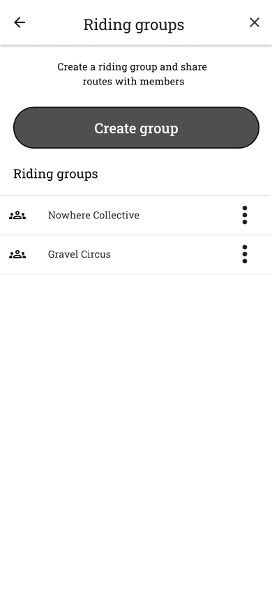
Open the main menu and select Riding groups. You see all the driving groups you belong to, and you can create a new group +-button.
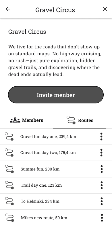
The group's view includes:
- Name and description
- Members and Roles (founder, route editor, member)
- Routes shared in a group
- You can also edit the group's information if you are its founder
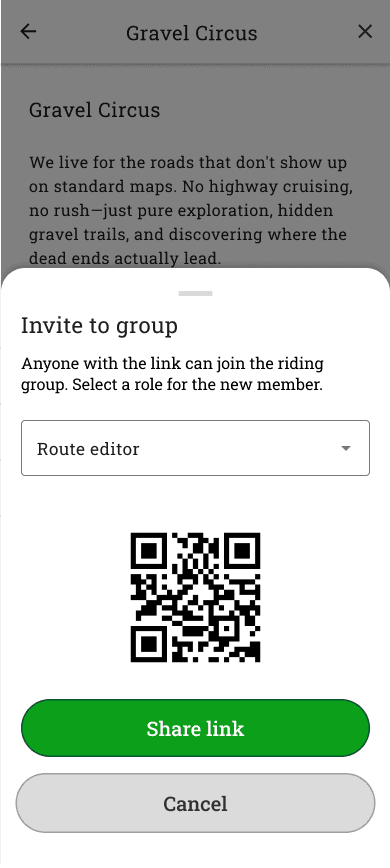
Invite to group
- Press Invite member button.
- Choose role: Route editor or Member.
- Select Generate invitation link.
- Share the link or show the QR code to your friend.
- By clicking the link or scanning the QR code, you can join the group.
Order
Certain features of the Bikenavi app require a valid subscription, which you can purchase From Google PlayYou can try the app for free for 7 days with your first subscription.
Once you have placed an order, the app store will send you an order confirmation to your email. You can manage subscriptions on Google PlayIf you have any problems with your order, you can contact us. with a feedback form.
Certain features of the Bikenavi app require a valid subscription, which you can purchase from the Apple Store. You can try the app for free for 7 days with your first subscription.
Once you have placed an order, the app store will send you an order confirmation to your email. You can manage your orders In Apple AccountIf you have any problems with your order, you can contact us. with a feedback form.
Cancellation of order
You can cancel your subscription at any time:
- Open Google Play Store -app on your device.
- Tap the one in the top right-hand corner profile picture (ensure that you are logged into the correct Google account).
- Select Payments and orders > Orders.
- Search and select Bikenavi.
- Tap Cancel subscription and confirm your selection by following the on-screen instructions.
You can also make the cancellation directly via the browser: play.google.com/store/account/subscriptions
Cancellation of order
You can cancel your subscription at any time:
Unlock the phone Settings.
Tap your own name at the top of the screen (Apple Account / Apple ID).
Select Orders.
Search and select Bikenavi.
Tap Cancel subscription (or Cancel free trial) and confirm the selection.
You can also make the cancellation directly via the browser: account.apple.com/account/manage/section/subscriptions
Deleting the account
Deleting a Bikenavi account
You can delete your Bikenavi user account and all associated data by sending us a support request:
On the support form: Fill in contact form
By email: Send request to info@bikenavi.fi
Remember to include in the request:
Linked to your Bikenavi account email address
Request for permanent deletion of account and data
We will process the deletion request as soon as possible. Upon deletion of the account, all saved routes and driving data will be permanently removed.
Note: If you have an active subscription, cancel it directly from your device's app store settings (Google Play or Apple App Store) before deleting your account.
If you can't find the answer to your question, you can also contact us!


 Finnish
 English
 Swedish
 German
 French
 Spanish