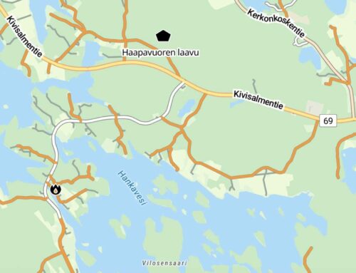
The update to the Finnish map layer received positive feedback, so we added a corresponding modified layer for Sweden and Norway as well. The new layer makes smaller roads visible at an earlier stage than before. For example, in Google Maps, many forest roads or local roads only appear when zoomed in very close, while in Bikenavi's modified layer they are already visible when viewed from a distance (zoom level 9-13). This makes planning significantly easier, especially when you want to explore more remote routes.

What's new 🔍
Small roads in Sweden and Norway are visible earlier than before, already at zoom levels 9–13
- It becomes easier to visualize the road network – you can see the structure more precisely without maximum zoom.
- There is no need to download the update separately – the change will automatically appear in the application and in the design version at app.bikenavi.fi.
The update improves route planning, making it even smoother and more versatile for cyclists of all levels.
Note for iOS users: This road network is not visible in the default map base. If you experience problems loading roads, reinstalling the app will restart the loading of the map tiles.

Tip 🔍
It's also worth trying out Google Street View when planning your route – you can use that feature by right-clicking on it.