About route planning
You can also plan your routes on your computer or tablet at app.bikenavi.fi. This is Bikenavi's web-based planning application, optimized for precise and efficient route editing. The larger screen and mouse control make planning clearer than on mobile.
Once your route is ready, you can open it in the Bikenavi mobile app and get going. Route planning and the mobile app work seamlessly together.

This is how route planning works
Features
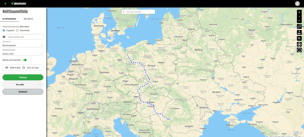
Works everywhere
Bikenavi goes with you everywhere – plan a route and navigate anywhere. The app works worldwide.
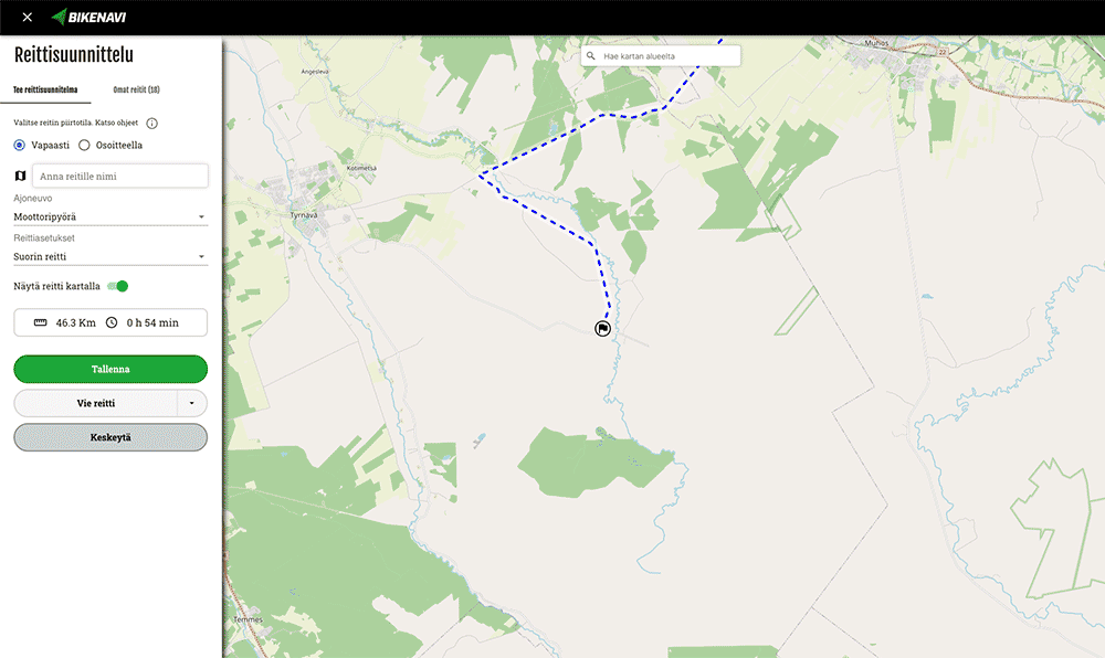
Two ways to plan a route
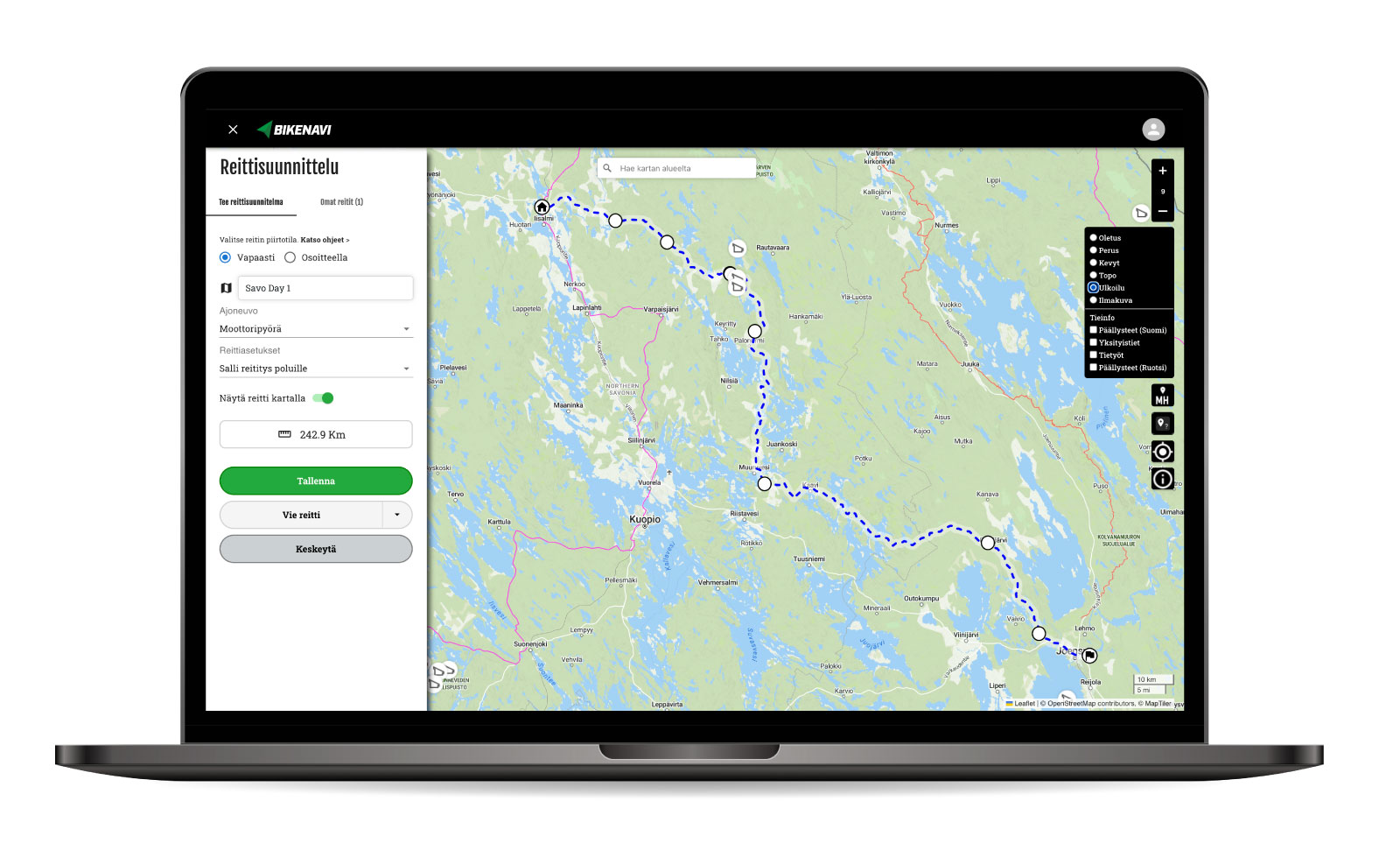
Option 1: Draw freely
You can freely build a route by adding, removing, and moving points on the map. Each point is editable, and you can also add waypoints to the route as needed. This method is especially suitable when you want to plan the route exactly according to your own wishes.

Option 2: Use addresses as a guide
The route is automatically created when you enter your starting point, destination and optional waypoints. All points can still be moved on the map, so you can freely fine-tune the route afterwards.

My routes
You can save your planned routes to My Routes, so they're always easily accessible. Saved routes are instantly visible in the mobile app and ready to go when you're on the go.

Unpaved roads on the map
You can easily identify unpaved roads on the map by their orange based on color. This makes it easier to choose the right route and helps predict the quality of the road surface at a glance.
Knowledge is navigation and clarity on the map – and best of all, The feature works in all countries. No matter where you are in the world, you always know what's under your tires.
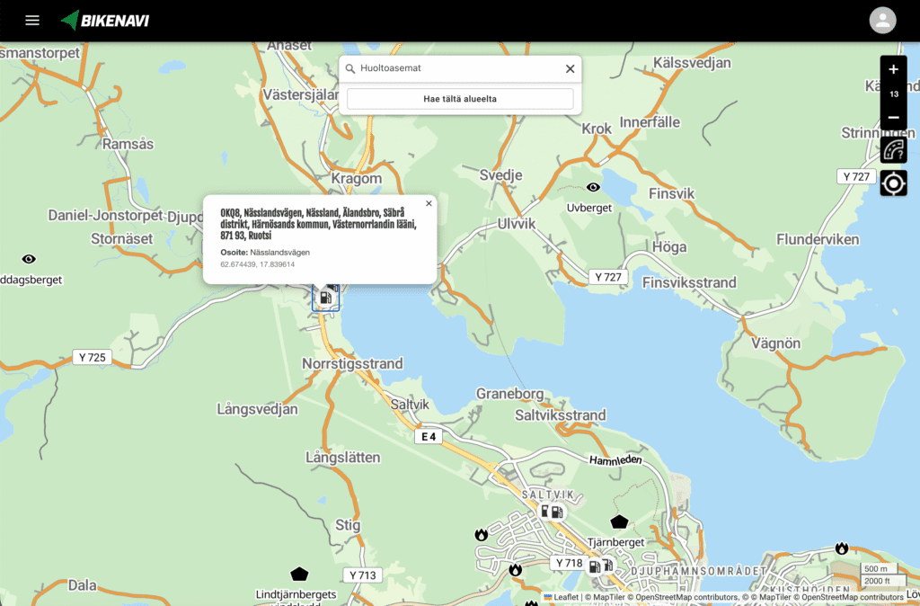
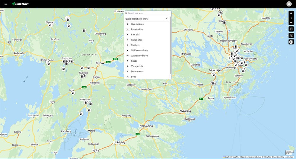
Search
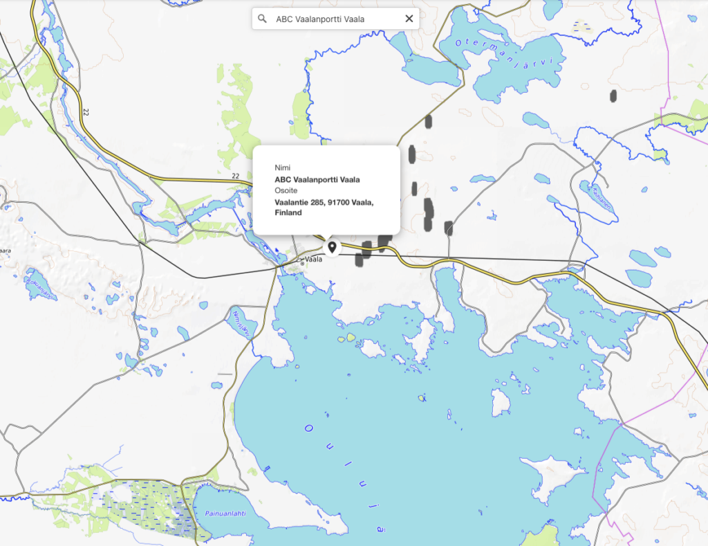
You can search for places by name, address, or category — for example, by city, business, street, or service type. The search field recognizes a variety of search methods and helps you quickly find the items that are relevant to your route planning or trip.
Shortcuts for searching
Shortcuts allow you to filter key locations on the map with one click:
-
Services and maintenance: Gas stations, shops, restaurants and accommodation are immediately available when you need to refuel or rest.
-
Rest areas and experiences: Easily locate the nearest lean-tos, campfire sites, wilderness huts, and the best viewpoints.
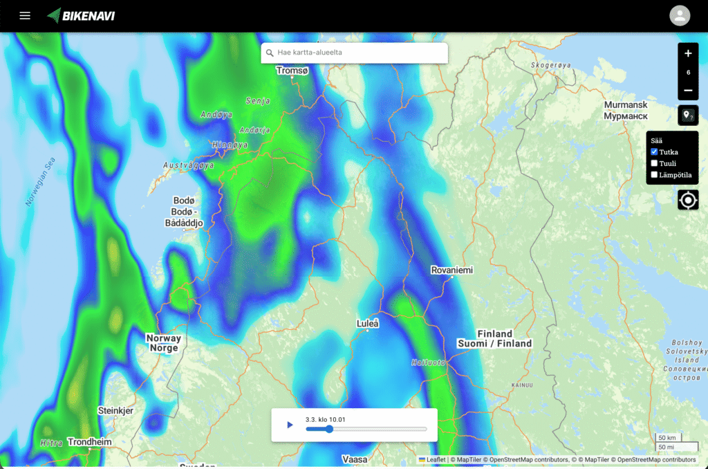
Real-time weather information directly on the map
Weather is an essential part of a successful trip. We've added a comprehensive weather service to the app, allowing you to monitor conditions in real time:
-
Weather radar: Follow the movement of rain fronts and time your breaks correctly.
-
Wind and temperature: Plan your route with wind conditions in mind and be prepared with the right equipment. Now you can check the weather forecast for your entire route without leaving the app.
Google Street View
Right-click to get a Google Street View view of the road. You can use this to help you plan your route.

Route export
You can also save a route in Bikenavi As a GPX file* and download it to your desired navigation device.
*GPX (GPS Exchange Format) is a file format used to store and share GPS data.
Works together
Route planning and the Bikenavi mobile app work seamlessly together.
Try route planning at
